Tour suggested
Colon Free Zone
Portobelo Tour
The Caribbean province of Colon has seen some colorful history.
First came the Spanish, harried by scavenging pirates.
Then in the 19th century came the gold rush 49ers from the east coast of the
United States , willing to
face the rigors of walking through Panama 's humid jungles to seek riches in
California . A
historic railroad the first ever to cross a continent was built to speed them on
their way. Then, at the beginning of the 20th century, came the great days of
the construction of the Panama Canal
.
The good news for the visitor is that not only are there fascinating
reminders of these different ages to visit, but the setting is spectacular:
turquoise waters, palm-fringed bays, tropical flowers and forested hills. And as
well as seeing the sights, you can scuba dive or snorkel, or spend a day or two
relaxing on the island of Isla
Grande .
There are two Spanish forts to visit: one at Portobelo and the other, Fort San
Lorenzo , within the former United
States army base of Fort Sherman
. The easiest to get to is Portobelo, just
35 minutes drive east of the main Colon-Panama road, and a little over two hours
from Panama City
. The Spanish sent gold and silver from their South American
colonies to Portobelo to await ships back to
Europe . But attackers such as Sr. Francis
Drake, Henry Morgan and Edward Vernon broke through their defenses too many
times, and the Spanish were choosing other, safer routes by the end of the 17th
century. Portobelo has been nothing but a small
fishing village with some interesting ruins ever since.
Scattered around Portobelo there are
several different sets of ruins, some in surprisingly good condition, complete
with cannons pointing out to see, stone walls, etc. The first set is visible
from the main road, on the left side, as you enter this beautiful bay that cuts
deep inland. As well, on the right side up on the hill, there are other small
ruins. A second set of ruins is in the middle of the village itself. The customs
house has recently been restored and contains exhibitions on the area's history.
Across from the first set of ruins, on the other side of the bay, is another set
of ruins. There are actually three different forts straddling the hillside, with
the two upper sections offering terrific views of the bay and town of Portobelo
. There is stone trail that leads from the lowest fort, which
resides along the water's edge, to the middle one, which is rather close and can
be see from the lower section. It's an easy, short walk. To visit the third and
highest fort, you'll have to hike along a wide, steep trail. The upper fort has
no views of the lower sections, but has stunning views of Portobelo and surrounding areas. Visiting this last set of
ruins across the bay is well worth the trip.
Colon Free Zone :
Nearly all world routes pass the Colon Free Zone located as it is at
the Atlantic gateway to the Panama Canal with access to both the Atlantic and the Pacific.
Wholesalers and retailers travel to this Free Zone because here they
are able to buy all consumer products either by the container load or in smaller
quantities, because Free Zone importers specialize in bringing in container
loads of goods, and breaking them down for resale.
Historically the Zone has staked its ground on importing goods
duty-free from around the world and selling them to tariff-bound Latin America . With that business basis no longer
relevant as Latin tariff barriers have fallen, the Zone has had to reshape and
expand its business according to the ground rules now prevalent worldwide:
globalization of trade, speed and efficiency of transit, and competitive
prices
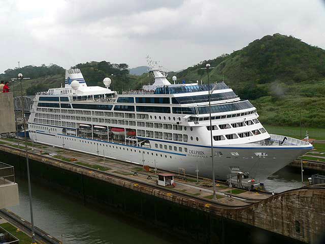
Gatun Locks:
The biggest locks in the Panama
Canal , Gatun Locks on the Atlantic side of the canal does the work
of two set of locks on the Pacific side:the Miraflores and Pedro
Miguel Locks.
That makes Gatún Locks absolutely massive
and a very impressive sight, a little less than a mile (more than
1.5
kilometers ) from end to end. A couple of observation
platforms give an excellent view of the locks, the Caribbean entrance to the canal, and Lago Gatún. There is also a
small scale model of the entire canal.
Nearby is the well maintained town of Gatun . A visit will give a taste of what life
in the old Canal Zone looked like
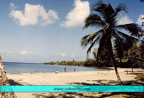
Langosta Beach
:
Of course you must know this by now, the
Atlantic coast of Panama has no tides, so the beaches
in Colón are safe, with white sand. The best beaches in the whole country are in
Colón, the most famous being Playa La Angosta, on
Sundays, people come all the way from Panama City in busloads to swim at this
popular beach
Railroad:
Yes, only in Panama can you go from the Pacific coast to the
Atlantic coast - in about one hour and find yourself in an idyllic Caribbean setting. Colón lies less than an hour by road
from Panama City
, or by the luxurious Historical Panama Canal Railway. This is an
amazing trip. The train leaves the terminal in Corozal
at 7.15
a .m. and arrives in Colon at 8:15 a.m.. It
returns from Colon at 5:15 p.m., arriving in
Panama City at
6:15 p.m. The views of Gatun
Lake , the Panama
Canal , and the rainforests are beautiful. The train is a
beautifully restored locomotive complete with a splendid observation car. On the
trip, which lasts about one hour fifteen minutes, a complimentary snack box is
served.
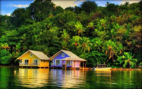
Isla Grande:
A small island about an hours drive from Colón, is a must visit, even
if you dont go to the Island itself, just the drive up to Isla Grande is worth
it. The Island itself is about 5 minutes boat ride from
the small village
of La Guayra
. Lush verdant landscape, crystal clear waters, and a laid-back
Caribbean atmosphere, friendly locals make Isla Grande
Panama
's most popular island vacation spot. Isla Grande offers
the visitor snorkeling, diving, surfing, jet-ski, boatrides, banana boats, and relaxation. Numerous
inexpensive cabins, as well as larger, more expensive hotels cater to all. The
islands waterfront restaurants and bars make for a peaceful and worthwhile
visit.
drink specialties, art and photography exhibits, and other family-friendly
entertainment.
The Customs House has been restored and is a good place to see some
of the history. Portobelo is also famous for it's
Black Chris
Portobelo:
The quaint town of Portobelo lies 20 miles northeast of Colón (about an
hour's drive from Colon
) and was connected by a stone highway "El Camino Real" with Old
Panama. Later on, it was accessible only by boat from Colon . It is situated in a
splendid harbor which was discovered and named by Christopher Columbus when, in
1502, his vessels sought shelter in the "Portobelo"
meaning " Beautiful Port " from a great storm. The town was
founded in 1597 and was given the name of San Felipe de Portobelo in honor of King Phillip II of Spain .
From its commercial demise when the isthmus became independent from
Spain in 1821, until a few
years ago, Portobelo, the Spanish
Main ’s richest treasure port, mouldered,
a roadless fishing village with an annual flicker of
life for the Black Christ celebration. Now, approached by an excellent highway,
the Spanish Main , albeit time-weary, is there
for all to capture single-handed.
Portobelo is one of the oldest Spanish settlements on the Caribbean coast and
at one point was the center of the Spanish Main
. It was through Portobelo that almost all of
Spain 's plunder was
accounted for before being shipped back to Spain .
The bay was heavily guarded by forts on both sides and was host to one of the
largest annual fairs in the Americas at the time.
Portobelo was the port of entry and of exit for all of South America . The exchange of merchandise took place
annually at Portobelo in the form of a fair which
lasted from 30 to 60 days. During this time, this sleepy little place was a
beehive of activity. Transactions frequently totaled from 10 to 12 million gold
pesos. These fairs took place once each year until 1738 when, as a result of
continual attacks by pirates, Spain was forced to abandon the Isthmian route
for the longer but more secure one around Cape
Horn . The frequent pirate attacks forced the Spaniards to adopt a
convoy system. Each year two fleets of 40 to 70 ships sailed from
Spain , one bound for
Veracruz , the
other for Portobelo. The arrival of the fleet signaled
the opening of the great fair.
It was also fair game for the English pirates, like Drake and Morgan.
Much of the old settlement has been overrun by the local village but
there are still some good ruins and examples of the Spanish fortifications.
Portobelo suffered its first attack in 1596, even before it was officially
founded, at the hands of Sir Frances Drake who died of fever before he could
capture it and was secretly buried at sea off the entrance to the harbor. In
1668, Sir Henry Morgan attacked the town from the land and launched a surprise attack on
Fort Santiago el Principe. He then attacked the remaining Spanish garrison,
using monks and nuns to place scaling ladders against its walls. The city was at
the mercy of Morgan's men who launched upon an orgy of looting, debauchery and
torture. Portobelo lived through this reign of terror
however. Other buccaneers and pirates who attacked Portobelo were Englishmen William Parker in 1601 and Edward
Vernon in 1739.
The most interesting and historic ruins are also the ones most
accessible to the visitor. The forts of Santiago and San Geronimo are each but a
5-minute walk from the pier. The forts are a neat place to explore. Cannons
still point out to sea, although the munitions depots are now empty and the only
permanent inhabitants of the fort are countless crabs. The forts are not
massive, and there isn't a lot to see, but it's interesting to look out over the
bay and realize that Sir Francis Drake, the first Englishman to circumnavigate
the globe, died in Portobelo and lies buried under the
silt in the sea nearby.
Even closer is the "Customs House", built in 1630, the remains of the
church of La Merced, and the church of San Felipe, the last building to be built
by the Spaniards. It was inaugurated in 1814. Its most carefully guarded and
priceless relic is a beautifully carved statue of Jesus of Nazareth which,
because of the dark wood from which it is made, is known as the "Black
Christ"
Every year on the 21st of October, Portobelo relives a day of its glorious past in a
celebration in honor of the Black Christ. The city is filled with people in a
candlelight procession. The statue of the Black Christ is brought out of the
church on a platform borne by 80 men and is carried through the streets of the
city. It is followed by hundreds of pilgrims carrying candles who march behind
it until it is once again restored to its resting place.
Every two years, the Festival of Diablos and Congos brings a burst of color and drama to Portobelo. Tourists and locals alike are drawn to the San
Jerónimo Fort and other smaller sites in Portobelo to see the Congos, Diablos, musicians, and singers who have come from many
towns and the provincial capital of Colón. The artists and performers bring
their best skills and talents to the masks, the costumes, the dances, and the
music that enliven the Festival. It is a spectacle not to be missed. Other
complementary activities that share in the celebration of the area’s long and
proud Afro-colonial heritage include a crafts fair, a farmers’ market featuring
regional food and
Fort San Lorenzo
The fort at San Lorenzo was first
built during the late 16th century (the actual year varies). King Philip II of
Spain
ordered a fortress to be built to overlook the mouth of the
Rio Chagres which was heavily used by commerce and slaves ships. This entry was
also the easiest route for marauding pirates and buccaneers looking for booty,
and the location of the fort provided an excellent view of any approaching
ships. Unfortunately, this first fort was made of wood and and began to deteriorate in the humid and rainy climate of
Panama
's six-month long rainy seasons. Between the rotting wood
and the attacks by pirates, it began to deteriorate and eventually fell, helped
along by the pirate and slaver, Francis Drake, who set fire to it in 1596.
The fort was eventually rebuilt but in 1671, it was captured by
Joseph Bradley who was under orders from Henry Morgan, the infamous pirate.
There were approximately 350 people stationed at the fort and in the battle, all
but 30 died, with no officers being left alive. Bradley lost approximately 100
of his own men with many injured. Morgan arrived less than a week later and soon
afterwards, Bradley died of his own wounds.
Morgan did not destroy the fort at this time but instead continued
with his plans to destroy Panama Viejo ("Old Panama") by returning to the
Pacific side. During this time, Portobelo (also
spelled as Porto Bello), another important trading and treasure port, had also
been attacked by pirates, including Morgan, and Spaniards alike, both whom had
been waging a deadly battle for control due to it's
important location on the coast. Another fort was established there by the
Spaniards and some of the ruins remain standing today as they do at Fort San Lorenzo .
For weeks, Morgan raped and looted Panama , leaving nothing by stone ruins, and when
his appetite was finally sated, he returned to Fort San Lorenzo where he and his men rested
and regrouped. However, he also made the decision during this time to sail for
Jamaica
so when leaving, he set fire to what remained of the fort
and burnt it to the ground. A year later, Morgan returned to England where he
spent three years and after making friends with royalty, was appointed Acting
Governor for the Duke of Albermarle and Lieutenant
Governor of Jamaica, along with a number of other important offices. The Duke
arrived in 1687 take over the governorship and Morgan died the next year in
Port Royal .
The fort was rebuilt by the Spaniards in a slightly higher location,
an odd-shaped cliff, this time using masonry. But records for the following
years are sketchy, probably due to lack of any major battles at the site, so
little information is known. But in March 1740, a British Admiral, Sir Edward
Vernon, acting under orders from Britain to capture Portobelo and Fort San
Lorenzo , bombarded the fort with his ship's cannons
until the Spaniards gave up. After plundering the buildings and taking what they
found, Vernon 's
men set fire to one of the buildings, destroyed the "castle" then sailed away
for Portobelo.
In 1761, the fort was repaired and fortified but never again attacked
by pirates. It gradually lost its importance as the years went by but in the
first decades of the 19th century, after Panama gained its' independence from
Spain but became the property of Colombia, it was once again in use but this
time as a prison. When the 49ers poured into Panama with dreams of gold lying on the ground in
California , it became a main traveling point
for crossing the isthmus to Panama , where the 49ers needed to catch the
ships to California
. But it once again fell into obscurity when the Panama Railroad was
completed and the travel routes changed.
It is what's left of the 1761 fort that is standing today, having
been a part of history for over 400 years. When touching the stone walls of the
fort and climbing through the ruins, one's imagination can only wonder if during
these 400 years, other hands touched the exact same spots or tread through the
same pathways or admired the same view. Standing at the farthest point to get a
clear view of the Rio Chagres, you can close your eyes and know that you have a
connection to history by just being there.
Ecotourist’s Paradise
The 12000-hectare San Lorenzo Protected Area (SLPA), located at the
northwestern entrance to the Panama Canal, is currently part of the Mesoamerican
corridor of protected areas extending from Guatemala to the Colombian border.
The SLPA contains two forts built for similar protective functions:
Fort San Lorenzo at the mouth of the Chagres River, first initiated by the
Spanish in 1597 to protect the "Camino de las Cruces,"
the gold route over the isthmus; and Fort Sherman, started in 1911 to protect
the northern entrance to the Panama Canal, the 20th century's "royal corridor"
through Panama.
Both forts successfully fulfilled their military objectives, and
Fort
Sherman simultaneously
protected the area's natural resources during the 20th century. SLPA's setting is at a major crossroads, historicaly connected with the Spanish conquest, the legacy
of fortune seekers and the Chagres River including pirates and shipwrecks, the
building of the Panama railroad, the efforts of France and the United States on
the Panama Canal, and early agricultural activities.
The San Lorenzo Protected Area (SLPA) contains 3 ecological life
zones, 12 vegetation types, and at least 500 species of higher plants. Nearly
590 species of vertebrates have been identified within the SLPA, including 36
species of amphibians, 35 reptiles, 435 birds, 81 mammals; moreover, the
Chagres watershed and SLPA streams contain 42
species of freshwater fish.
Much of the fauna and flora of the SLPA are easily seen from
roadsides and trails. The SLPA also has a variety of attractive scenery and is
readily accessible by car. The picturesque historical and cultural attractions
of the SLPA highlight Panama as the crossroads between two
continents and two oceans.
The legacy of Spanish gold and Fort San Lorenzo, pirates, shipwrecks,
the first “intercontinental railroad,” the French attempt at a the sea-level
canal, and the building of the Panama Canal, Gatún
Locks, and Fort Sherman, are all interwoven into the history of the SLPA.
Tourists will find both terrestrial and aquatic activities, including
hiking along roads or trails, wildlife photography, bird watching, canoeing on
the Chagres , kayaking, and fresh or saltwater
fishing. The Caribbean shore, particularly west of Fort Sherman , offers quiet beaches, swimming,
scuba diving, and snorkeling.
The sandy coves and wooded ridges bordering the Caribbean shore
provide glimpses of passing vessels and views of the city of Colón across Limón Bay
. Along the Gatún Locks- Sherman Road , the
principal thoroughfare of the SLPA, wetland forests (mangrove, Pterocarpus, and cativo swamps)
and typical flora (mangrove ferns, large trees, and heliconias) are readily visible from vehicles.
Monkeys, sloths, and anteaters are often seen, as are several species
of birds, lizards, and butterflies, including the iridescent blue morpho (Morpho peleides). At Fort Sherman
, viewing the architecture of the residences, administration
buildings, and World War I batteries provides insights into military life during
the 20th century.
Hikers venturing along gravel roads and trails into the interior
encounter panoramas from rugged highpoints and occasional views of waterfalls,
small caves, and some of the more timid fauna of the SLPA. A short distance
away, the Panama Canal and Gatún Locks, traversed by ships from all over the World, add
to a memorable experience
·


